
The Sacred Headwaters of the Shasta River:
Sacramento River Headwaters
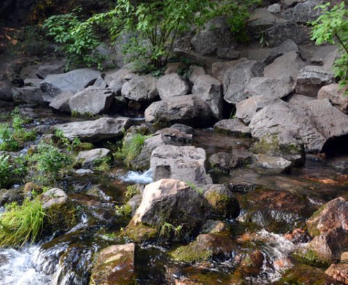
Mt. Shasta City Park, Shasta, California
One of the most magical springs in California, the Shasta Sacramento Headwaters is an easy-on, easy-off the I-5 just as you’re entering the city of Shasta Mountain coming from the North heading south. It is located at the base of “Spring Hill” within Mt. Shasta City Park. Temperatures are at a steady 36-40 degrees Fahrenheit and have a reliable continuous flow.
The City has stabilized the area around the Spring with large boulders and a paved area so that visitors can safely retrieve water from the headwaters by filling their bottles and jugs, which is an on-going pilgrimage for many. A great little city park as well with a playground for the kids, bridges, restrooms, picnic tables, bbq grills, and other resources. Several footpaths give a pleasant stroll around the 26-acre park. Some of these footpaths people have said are “fairy trails” with many magical beings amidst the woods. It is in many ways a great rest stop while following the I-5 through Shasta.
The Mt. Shasta Recreation and Parks District headquarters is located here. While many believe this to be the source of the Sacramento River, it is actually just one of many sources for this major river. The most northern watershed of Sacramento is located within Southern Oregon at Goose Lake where the Pit River drains the Modoc Plateau blending into the Sacramento as the eastern tributary of Shasta Lake and contributes four times as much water into the flow than the Upper Sacramento. The headwaters are often occupied by hippies, new agers, Native Americans, and/or Pagans drumming, dancing, meditating, or hanging out.
Article by Thomas Baurley, 8/28/2015
References:
- Exploringnorcal.com 2011 “Exploring Norcal: Sacramento River Headwaters – Mt. Shasta City Park – Mt. Shasta, CA” Website http://www.exploringnorcal.com/2011/07/sacramento-river-headwaters-mt-shasta.html visited 8/28/15.
- Findaspring.com 2015 “Sacramento River Headwaters Mt Shasta City Park California” Website http://www.findaspring.com/locations/north-america/usa/sacramento-river-headwaters-mt-shasta-city-park-ca/ visited 8/28/15.
- msrec.org 2015 “Mt Shasta Recreation and Parks District” Website http://msrec.org/ visited 8/28/15.
- Roadtrippers.com 2015 “Headwaters of the Sacramento River” Roadtrippers.com Website https://roadtrippers.com/us/mount-shasta-ca/nature/headwaters-of-the-sacramento-river?lat=40.80972&lng=-96.67528&z=5 referenced 8/28/15.
- Wikipedia 2015 “Shasta River”, “Sacramento River”. Wikipedia: The Free Encyclopedia. Website https://en.wikipedia.org/wiki/Shasta_River visited
on 8/28/15.

The Sacred Headwaters of the Shasta River